Sydney’s Underwater World To Be Launched At World Parks Congress
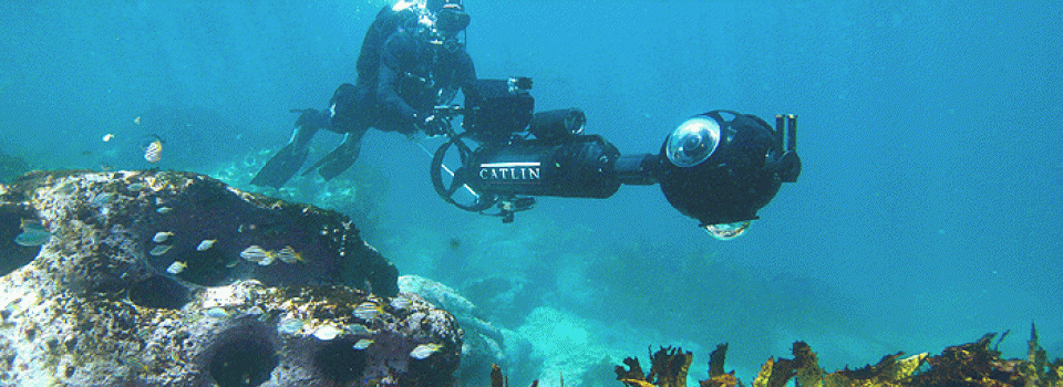
Article Image Credit: Catlin Seaview Survey
The Catlin Seaview Survey teams up with the Sydney Institute of Marine Science and Google to record and reveal the marine life of Sydney.
“Underwater Street View comes home”
The Catlin Seaview Survey, sponsored by international insurance company Catlin Group Limited, has partnered with the Sydney Institute of Marine Science (SIMS) to carry out a scientific survey of the world famous Sydney harbour and surrounding coastline.
It is using its revolutionary 360-degree panoramic SVII camera to record and reveal this surprisingly bio-diverse marine environment – arguably the best of any major city in the world.
Images captured during the survey will be published in Google Street View so everyone can explore underwater Sydney in a ‘virtual diving’ experience. Over a billion users of Google Maps will be able to access the imagery.
However the main purpose of the survey is not just revealing what lies beneath the surface, but creating a scientific baseline record of the marine environment that can be used to accurately monitor change over time. The scientific data from the survey will be made publicly available on the Catlin Global Reef Record so that anyone can help assess change in the future.
“It is great to be able to work with SIMS on a survey in Sydney” said the project’s Executive Director Richard Vevers. “This is where the Catlin Seaview Survey was born and where the Underwater Earth team is based. It is a magical place that’s very close to our hearts. It really feels like the project is finally coming home”.
“The original idea was developed here, however we’ve spent most of our time so far revealing the world’s coral reefs. It is just as important to record temperate waters and we’re excited to be expanding the scope of our work – especially here in Sydney.”
The survey, which kicked off on Monday 3rd March, will focus mainly on the outer harbour area and surrounding coastline. “This study will be an exciting addition to our Harbour Programme – a comprehensive assessment of what is one of the most biologically diverse harbours in the world”, said Professor Emma Johnston who heads up the SIMS Harbour Programme.
Nabil Naghdy, Product Manager for Google Maps, Australia and New Zealand added “once the imagery goes live on Google Maps later this year, nature lovers from all over the world will be able to take a virtual dive into the heart of Sydney’s underwater world. We hope this new Street View imagery not only advances important scientific research, but also inspires people to learn more about the delicate ecology of Sydney Harbour and our local beaches.”
The University of Queensland’s Global Change Institute (GCI) is the founding scientific partner of the Catlin Seaview Survey. The development and coordination of the sampling protocol of the Catlin Seaview Survey has been driven by the University of Queensland's extensive scientific capability. GCI Director and Catlin Seaview Survey Chief Scientist Professor Ove Hoegh-Guldberg will collaborate with SIMS on this project.
The Street View imagery will be launched at the IUCN World Parks Congress in November in Sydney.
MEDIA IMAGERY:
Media photos of the underwater survey can be downloaded at: www.catlinseaviewsurvey.zenfolio.com/sydney Please credit all images as listed in media gallery. (Free use with credit to Catlin Seaview Survey, no on-pass.)
NOTES:
More information about the Catlin Seaview Survey can be found here: www.catlinseaviewsurvey.com Existing 360 degree images taken by the Catlin Seaview Survey team can be seen in Google Views / Street View here: https://www.google.com/maps/views/streetview/oceans
Video B-Roll of SVII camera in action on Great Barrier Reef (more video available by request)
https://www.hightail.com/download/elNLTG00WlQwMEVFSzhUQw
You can also engage with the Catlin Seaview Survey and its 3.6 million followers on Google+ here:
https://plus.google.com/+CatlinSeaviewSurvey/posts
The Catlin Seaview Survey recently launched the Catlin Global Reef Record www.globalreefrecord.org - a first-of-its kind global database and online standardized research tool relating to major reef ecosystems.


